
How GPS Knows Exactly Where You Are: Satellites to Relativity
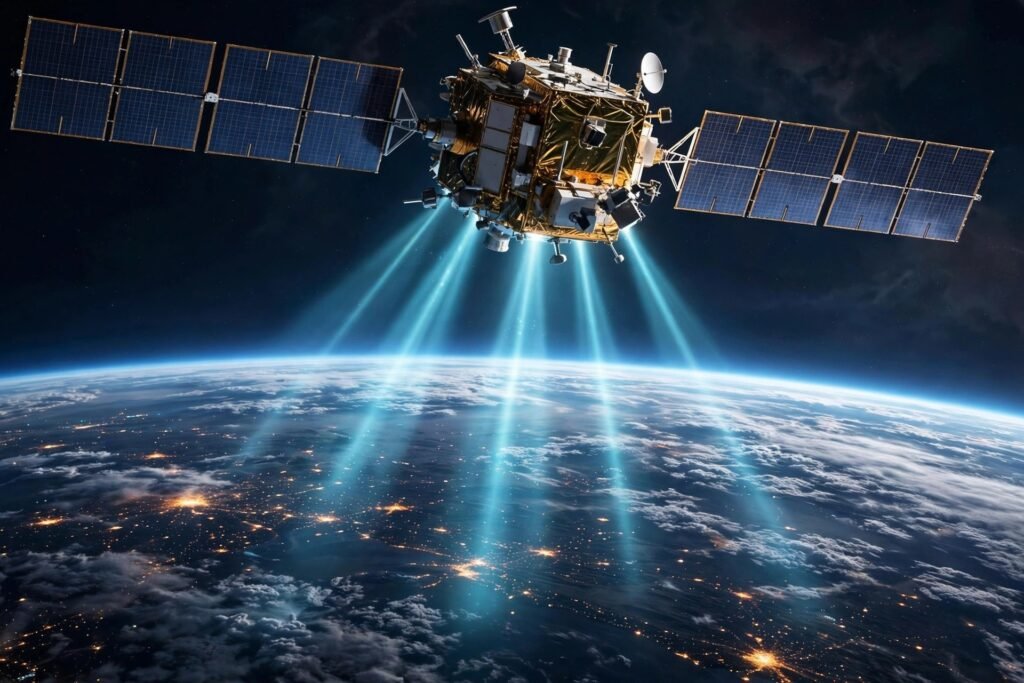
You open your maps app in an unfamiliar city, and within seconds a blue dot appears — not just your street, but which side of the street, accurate to a few meters. It feels like magic, but it is one of the most extraordinary engineering achievements in human history: a constellation of satellites, atomic clocks, and Einstein’s relativity working together to pinpoint your position anywhere on Earth. Here is how GPS actually knows exactly where you are.
This guide explains the satellite constellation, the trilateration math, the atomic-clock precision, the relativity corrections, and why your phone sometimes thinks you are across the street.
The Constellation: 30+ Satellites, Always Overhead
GPS (Global Positioning System) is operated by the U.S. Space Force and consists of 31 active satellites orbiting at ~20,200 km altitude, arranged so that at least four are visible from any point on Earth at any time. Each satellite continuously broadcasts two things: its exact position (from precisely tracked orbital data called ephemeris) and the exact time the signal was sent (from onboard atomic clocks).
Your receiver — phone, car, watch — is passive: it only listens. It does not transmit anything to the satellites (a common misconception). The U.S. government’s official GPS information site (gps.gov) documents the system architecture and its free civilian availability — a public utility beamed from space.
Trilateration: The Core Math
The positioning principle is called trilateration (not triangulation — no angles are measured, only distances). Here is how it works:
Step 1: your receiver picks up a satellite’s signal, which contains the transmission timestamp. Comparing it to the reception time (on your receiver’s clock) gives the signal’s travel time. Step 2: multiply travel time by the speed of light (~300,000 km/s) to get your distance from that satellite. You are somewhere on a sphere of that radius centered on the satellite. Step 3: repeat with a second satellite — the two spheres intersect in a circle. Step 4: a third satellite narrows it to two points (usually one is absurd — deep in space or inside the Earth — so it is discarded). Step 5: a fourth satellite resolves the final ambiguity — and critically, corrects your receiver’s clock error (more on this below).
Three satellites give a 2D position (latitude/longitude); four give full 3D (adding altitude) plus time synchronization. This is why GPS needs at least four visible satellites — and why deep urban canyons or indoors, where buildings block the sky, degrade accuracy: fewer satellites, worse geometry.
Atomic Clocks: Precision Beyond Comprehension
The entire system hinges on absurdly precise timing. Light travels ~30 cm in one nanosecond — so a one-microsecond clock error means a 300-meter position error. Each GPS satellite carries multiple atomic clocks (cesium and rubidium) accurate to within billionths of a second, synchronized continuously by ground control stations.
Your phone has no atomic clock — its cheap quartz clock drifts significantly. The genius of the system: the fourth satellite’s measurement lets the receiver solve for its own clock error as a fourth unknown (x, y, z, + time bias). Your phone essentially derives atomic-clock-grade time from the satellites — which is why GPS also synchronizes the world’s financial networks, power grids, and cell towers. The National Institute of Standards and Technology (NIST) maintains the time standards underpinning this global synchronization.
Einstein Runs Your Maps App: The Relativity Corrections
Here is the most beautiful detail: GPS would fail within minutes without correcting for Einstein’s relativity. Two effects compete: Special relativity — the satellites move at ~14,000 km/h relative to you, so their clocks tick slower by about 7 microseconds per day (time dilation). General relativity — the satellites experience weaker gravity than you do, so their clocks tick faster by about 45 microseconds per day (gravitational time dilation).
Net effect: satellite clocks gain ~38 microseconds per day relative to ground clocks. Uncorrected, that is a 10-kilometer daily position drift — your blue dot would wander off into the next county within a day. GPS satellites’ clocks are pre-adjusted before launch to tick slightly slow, exactly compensating. Every time you navigate somewhere, you are conducting a live experiment confirming Einstein’s theories — the most practical application of relativity in daily life.
Why It’s Sometimes Wrong: Error Sources
Civilian GPS accuracy is typically 3–5 meters — remarkable, but imperfect. The error sources: atmospheric delays (signals slow passing through the ionosphere and troposphere — the largest error source; dual-frequency receivers correct most of it), multipath (signals bouncing off buildings before reaching you — the “across the street” error in cities), satellite geometry (satellites clustered together give poor triangulation — measured as DOP, dilution of precision), clock/ephemeris residuals (tiny remaining errors after corrections), and obstruction (tunnels, parking garages, dense forest block signals entirely).
Your phone compensates brilliantly: assisted GPS (A-GPS) uses cell towers and Wi-Fi positioning for instant rough fixes while waiting for satellites; sensor fusion blends GPS with accelerometer, gyroscope, and compass data to smooth the track; and mapping databases snap you to the nearest road. The blue dot is a best estimate from multiple fused sources, not raw GPS alone. Your receiver’s passive listening is also why location privacy matters — learn how to stop apps from tracking your location when you want the blue dot to yourself.
Beyond GPS: The Other Constellations
GPS is American, but it is not alone: Russia’s GLONASS, Europe’s Galileo, and China’s BeiDou are fully operational global systems. Your phone typically uses several simultaneously (multi-constellation GNSS), dramatically improving satellite availability and accuracy — that fast, precise fix in a downtown canyon is the constellations working as a team. The same satellite know-how powers modern travel — from finding cheap international flights to navigating foreign streets.
Conclusion
GPS knows where you are through an elegant chain: satellites broadcast their positions and atomic-clock timestamps; your receiver measures signal travel times, converts them to distances, and solves the trilateration geometry — using a fourth satellite to fix its own clock error. The whole system is corrected for Einstein’s relativity (without which it would drift kilometers daily) and refined by atmospheric models, multi-constellation signals, and your phone’s sensors. It is easy to take the blue dot for granted. Do not: it represents atomic clocks in orbit, ground stations on five continents, and a century of physics — all so you can find the nearest coffee shop. That is not magic. It is better: it is engineering.
Frequently Asked Questions
How does GPS work without internet?
GPS itself needs no internet — your receiver passively listens to satellite broadcasts. Phones use the internet (A-GPS) only to get a faster initial fix and to download map data; the positioning works fully offline with pre-downloaded maps.
Why is my GPS sometimes inaccurate in cities?
Skyscrapers block satellites (fewer signals, worse geometry) and cause multipath — signals bouncing off buildings arrive late, confusing the distance calculation. This is why urban accuracy degrades to 10–50 meters in deep “urban canyons.”
Does GPS work without relativity corrections?
No — it would fail within a day. Combined relativistic effects make satellite clocks gain ~38 microseconds daily versus ground clocks, causing ~10 km of position drift per day uncorrected. GPS is the most commercially successful application of Einstein’s theories.
Can GPS track me without my knowledge?
GPS itself cannot track you — receivers only listen; they transmit nothing to satellites. Tracking requires a separate data connection (cellular/Wi-Fi) reporting your computed position to someone. Airplane mode with location off stops this.
What’s the difference between GPS, GLONASS, Galileo, and BeiDou?
They are independent satellite navigation systems run by the US, Russia, EU, and China respectively. Modern devices use them together (multi-GNSS) for better coverage and accuracy. GPS was first and remains the generic term, like “Kleenex” for tissues.